
NDOTA Membership Sign Up
NDOTA DISTRICT MAP
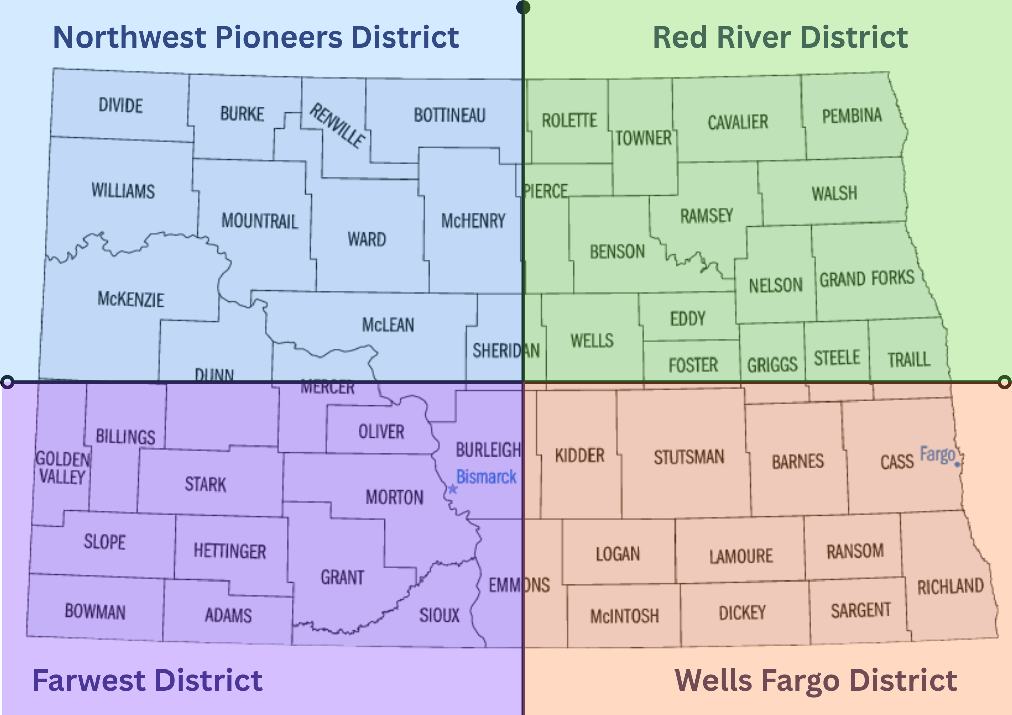
🟦 Northwest Pioneers District (Blue)
Counties: Divide, Burke, Renville, Bottineau, Rolette, Towner, McHenry, Pierce, Ward, Mountrail, McKenzie, McLean, Sheridan
🟩 Red River District (Green)
Counties: Cavalier, Pembina, Walsh, Nelson, Ramsey, Benson, Eddy, Foster, Wells, Griggs, Steele, Traill, Grand Forks
🟪 Farwest District (Purple)
Counties : Golden Valley, Billings, Stark, Slope, Hettinger, Bowman, Adams, Grant, Sioux, Emmons, Oliver, Morton, Burleigh (Bismarck), Mercer, Dunn
🟧 Wells Fargo District (Peach/Orange)
Counties: Kidder, Stutsman, Barnes, Cass (Fargo), Ransom, Richland, Sargent, Dickey, LaMoure, Logan, McIntosh